Sagrera Lineal Park


Sagrera Lineal Park
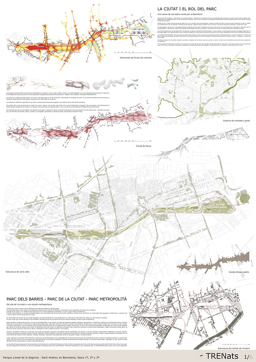
The City and the Role of the Park
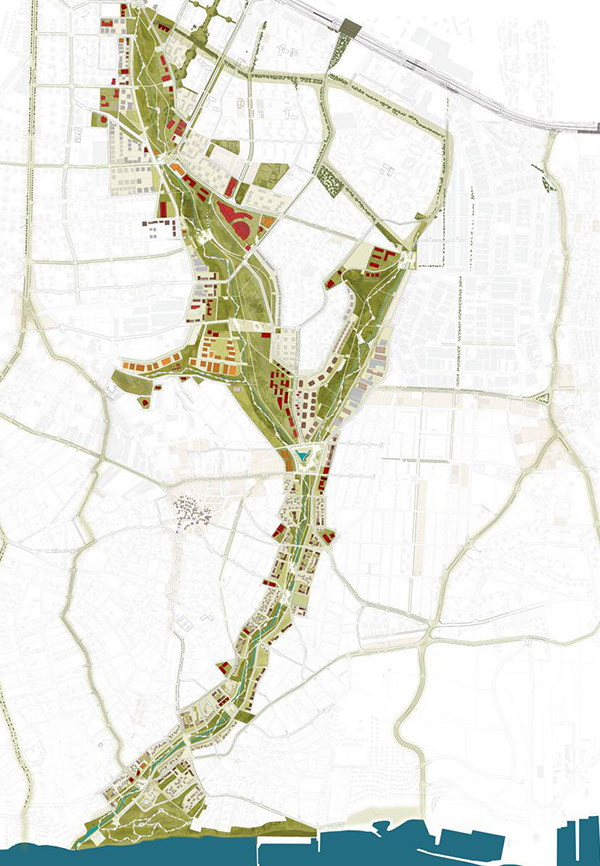
A network of green corridors for Barcelona
Given its size and location, La Sagrera-Sant Andreu Park is considered to be the future unifying axis, in civic and landscape terms, which will be established between the Plaça de Les Glòries intersection and the Nus de la Trinitat highway interchange, thus stimulating an urban transformation at the scale of local neighborhoods, the city and the adjacent metropolitan area.
One of the new park’s chief priorities will be to resolve this open wound and to make way for a fresh suture in terms of connectivity by creating new flows and cross-routes, promoting recognition of the neighborhoods affected, and the reformulation of a north-south urban continuum.
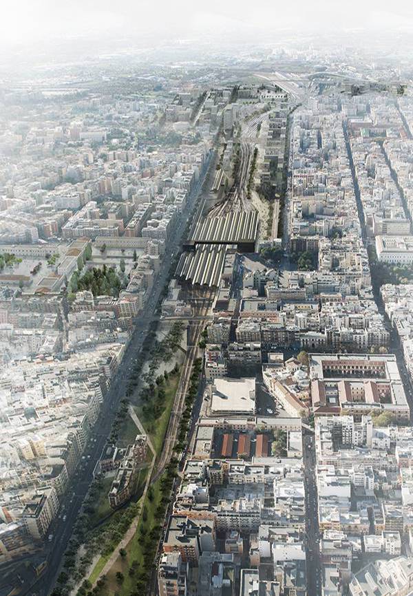
The proposal we are presenting is based on the concepts of network, grid, and itinerary, all of them adapting to a topography generated by the covering over of the train tracks hosted by the new La Sagrera station, which will provide services for suburban trains, high-speed trains and metropolitan transportation.
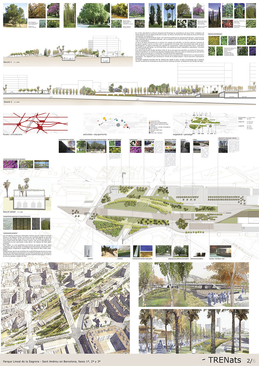
The Neighborhood Park
In the Bac de Roda Sector the orthogonal grid of the Eixample is consolidated at its borders and adapted to the existing weave pattern, as in other areas of the city. The pattern and dimension of the city block fills the empty spaces with its characteristic residential role.
The rail infrastructures have great presence from Torre del Fang, on account of the Bac de Roda Bridge and the new Station.
The Neighborhood Park links the empty railroad space and the architecture of the station in a measured landscaped and planted environment that penetrates into the grounds of the actual station and gently reclaims the architecture.
The vegetal fingers approach from the station and clasp the park, which extends towards the station, while the grid of the Eixample is diffused among the green zone that surrounds and emphasizes the Bac de Roda Bridge.
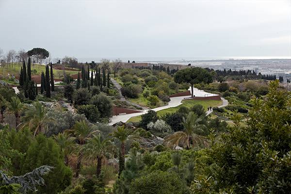
City Park
Given its size, the urban park of La Sagrera acts as a huge green lung for Barcelona and an ample recreational space that takes all kinds of users into consideration. The project is sensitive towards its location: it analyzes and understands the surroundings and responds to their connections. Two major areas are generated: a so-called intensive zone that will group together much of the more fragmented program, and an extensive zone, of greater size, that will be conducive towards more flexible and diverse programs.
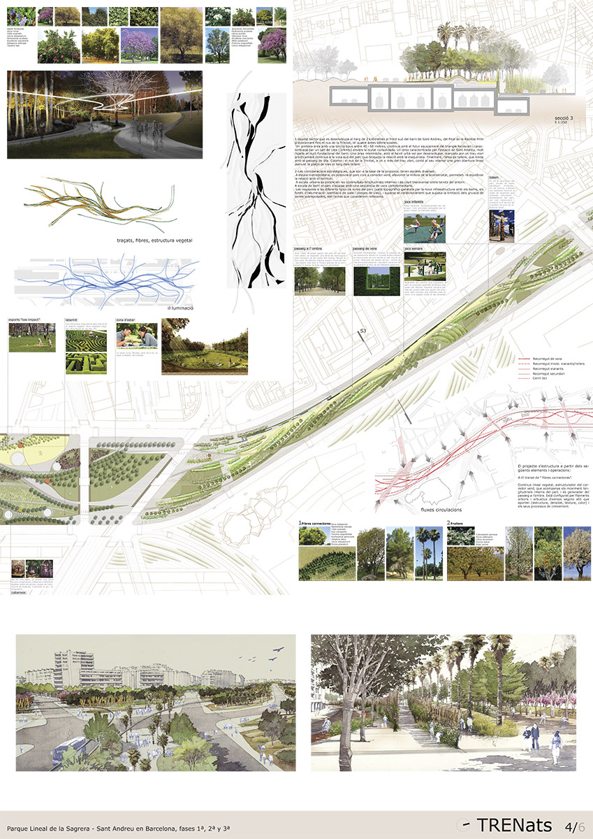
The Sant Andreu/Tallers Sector
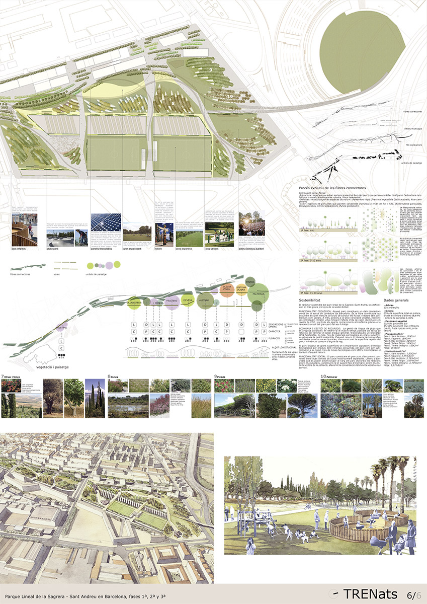
The strategic considerations that form the basis of the proposal have various scales: on the metropolitan scale the park is developed as a green corridor, leading to the improvement of biodiversity and striking a balance in its relationship with the territory. On an urban scale the internal longitudinal continuities are strengthened, as are those involving a form of cross-stitching between the surrounding fabrics. At the local neighborhood scale the park is endowed with a sequence of complementary uses. Responses to the different types of park edging—topographical rifts with the local neighborhoods generated by the new infrastructure, the lighting/ventilation holes for road traffic and rail sidings—and [error en el original?] the reconditioning involved in limiting the thickness of the topsoil are relevant issues.
The project is structured according to the following operations and constituent elements:
1 The braiding of “connecting fibers”
The linear vegetal continuum structuring the green corridor, which accompanies the longitudinal internal movements of the park and generates the walkway in the shade, is configured by various tree and shrub filaments as per their contribution in terms of structure, density, texture or color, and the processes of growth.
2 The landscape units
The rail infrastructure is indissolubly linked to the experience of traveling.
Recall of the landscapes traversed, forest plantations and crops typical of the Mediterranean will be the reference materials of the landscape units.
The sequence and variety of these favors the creation of locations with an identity of their own, thus regenerating, rather than reproducing, the reference landscapes.
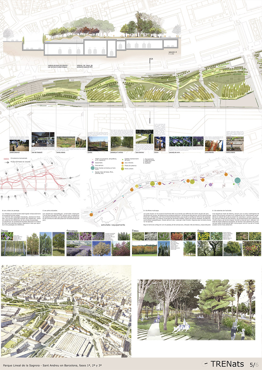
3 Undulating skins
The topographical sequences, constructed by means of the use of lightweight blocks of EPS, [qué es?] act as devices for moisture capture, which permit small variations in ground conditions and improve the biodiversity of the park.
4 Multilayer filters
The city has still not constructed the frontages of the new fabrics that will define the visual boundaries of the park.
The top layers of the fields, the walls of the former stations, and the fencing of the gardens, with a mixture of bushes and climbing plants, are places of intense biodiversity that help configure the form of the landscape.
With this idea in mind, a multilayer system of openwork screens covered with plant tissues makes use of topographic discontinuities and holes over the road and rail systems to create the backgrounds and façades the city has not provided.
Some stretches are configured as the pathway of sensations, on a more domestic scale typical of the garden.
5 Systems of activity
A linear sequence of totems act as intelligent service modules—lighting, Wi-Fi transmitter, CO2 capture, nebulizer, signage—around which are sited standard uses like kiosks, playgrounds, etc.
The uses of Sant Andreu Station are complemented by boules courts and urban allotments, in order to integrate it with the life of the neighborhood and the park. An area of equipped communal activities is seconded by the connecting footbridges that vault the Ronda de Dalt and communicate with the Nus de la Trinitat highway interchange.
Related Projects
- Balmes 145 Bajos
- 08008 Barcelona, Spain
- +34 93 238 51 36
- info@ferrater.com